
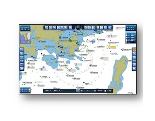
EyeMap-VMS (Vessel Management System )
•Real-time
display of marine and land Integrated location information based on GIS
(option:
land map)
•Monitoring
ability at the same time: 5,000 vessels
(Max: 100,000)
•Vessel
information inquiry: static and
dynamic
•Detailed
information of each vessel
•Real-time display of marine and land Integrated location information based on GIS (option: land map)
•Monitoring ability at the same time: 5,000 vessels (Max: 100,000)
•Vessel information inquiry: static and dynamic
•Detailed information of each vessel
EyeMap-VMS (Vessel Management System ) |